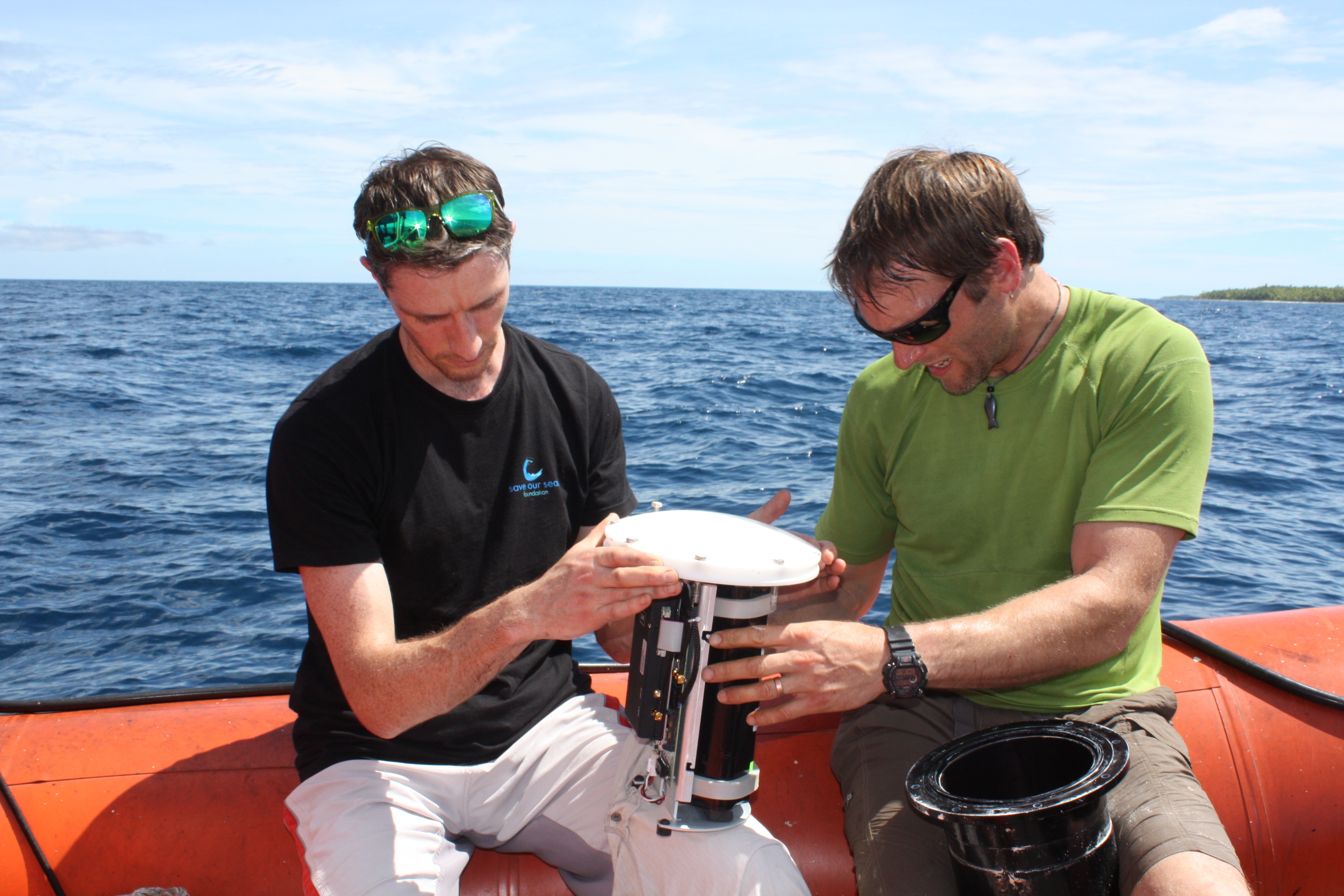
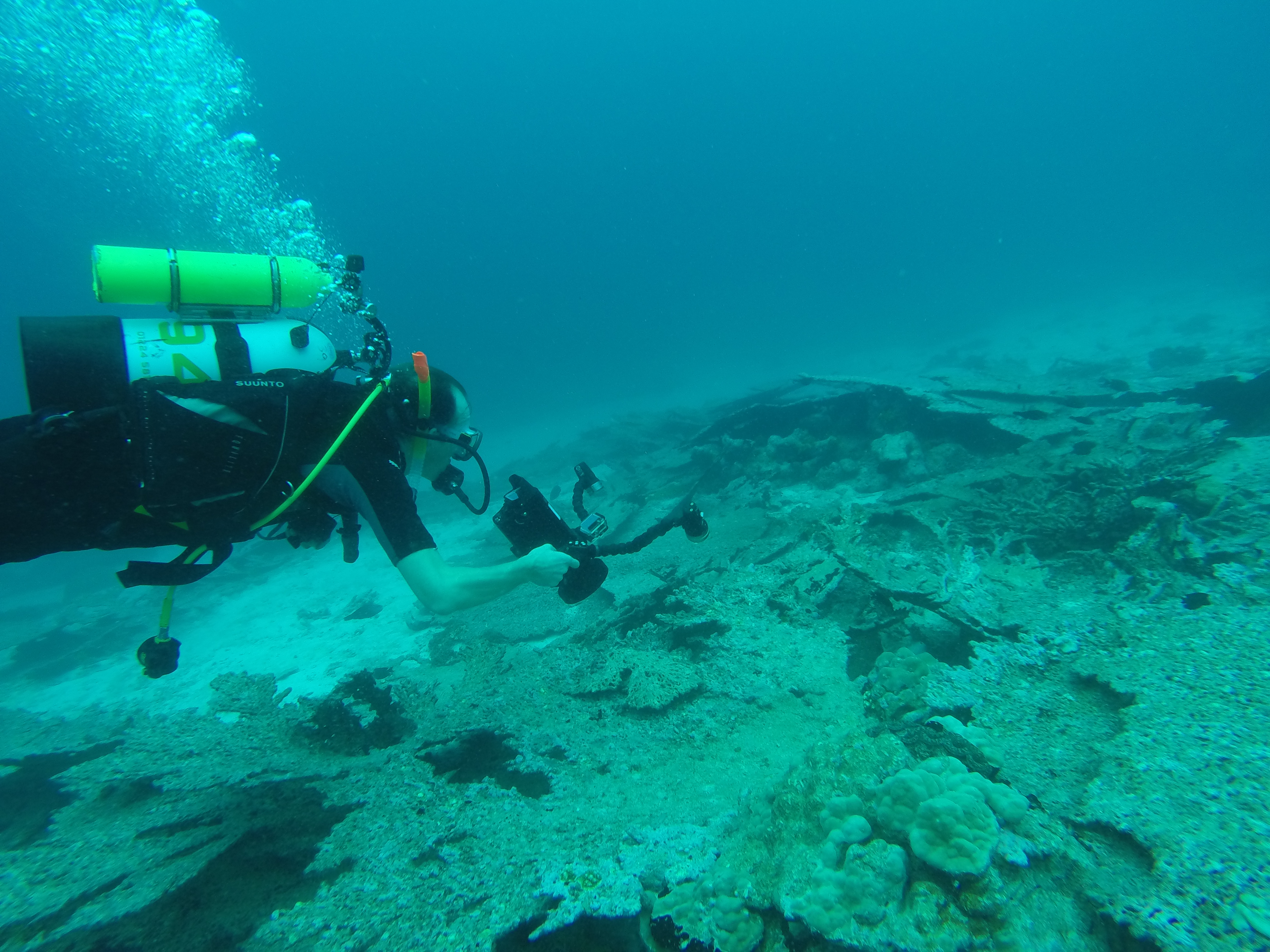
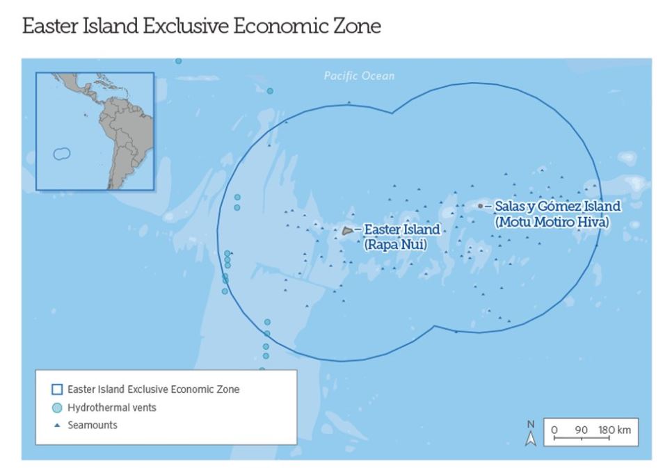
Overwhelming support from the Rapa Nui to create an MPA around Easter Island

On the first day of IMPAC4 in La Serena, Chile’s Ministers for the Environment, Marcelo Mena, and Minister of Foreign Affairs, Heraldo Muñoz, announced the results of a referendum held Sunday, 3rd September 2017 on Easter Island for the creation of a marine protected area. The vote, which had the largest turnout for a consultation ever held on the island, resulted in 73% approval for the creation of an MPA that would protect the island’s exclusive economic zone from industrial commercial fishing, mining and other extractive activities while grandfathering in Rapa Nui artisanal fishing.

The Pew Bertarelli Ocean Legacy Project issued the following statement in response to the vote.

Dona Bertarelli, co-chair of the Bertarelli Foundation said:

“I am delighted that the referendum has given such strong endorsement for the creation of an MPA around Easter Island. This demonstrates the value of working with local communities to achieve the best outcome to protect both their livelihoods and the oceans for generations to come.”

Matt Rand, director of the Pew Bertarelli Ocean Legacy Project said:

“This is a historic moment for the conservation of the world’s ocean, and the protection of the Rapa Nui environment and culture. We are thrilled that, after working with the community for over five years, the Rapa Nui have voted in support of a marine protected area. We are hopeful that President Bachelet will codify the Rapa Nui proposal.

There has been an extensive vetting process with the Rapa Nui and the final decision by the community is to support a marine protected area. This is the important step to hopefully realize the community’s vision to protect their ocean and culture. We have been privileged to have worked so closely with the Rapa Nui on this endeavor over the last five years. The power of this partnership between committed indigenous local people and our outside expertise has been remarkable.

The Rapa Nui have chosen conservation of the environment, their culture and their traditions over commercial exploitation. This should be commended. It’s not often that communities choose conservation over exploitation. Hopefully this sets the course for the rest of our world.”

More incredible data is collected from the Chagos Archipelago

In late April and early May, Dr David Jacoby of the Zoological Society of London and Dr Taylor Chapple of Stanford University spent a week at sea attempting to retrieve data from deep-sea receivers scattered across the marine reserve in the British Indian Ocean Territory. The receivers pick up signals from pelagic animals that the team tagged on previous trips including sharks, rays and tuna – the big predators that are hard to study but absolutely key to a healthy ecosystem.  These 16 receivers were deployed in 2016 in a variety of deep-water habitats such as sea mounts and undersea canyons, places too deep for divers and until now virtually unstudied by scientists.

In just six days, with the help of the crew of the British Patrol Vessel Grampian Frontier, the team traversed the Chagos Archipelago from end to end travelling over 500 miles. They managed to retrieve 12 of the 16 receivers by using an automated acoustic release system which ‘calls’ the receiver from the surface causing it to break free of its mooring and float up to be collected by the team.

Early analysis of the data from the receivers has revealed an incredible wealth of information; over 500,000 individual detections were downloaded – each one an individual pass of a tagged animal past one of the receivers. Receivers located at the Schwartz and Sandes seamounts in the south of the archipelago made detections of 159 unique individuals and are starting to reveal some of the connectivity between these deep habitats.

Dr David Jacoby and Dr Taylor Chapple service and replace the battery in a VR4 acoustic receiver, just south of Peros Banhos in the Chagos Archipelago, so that it will continue transmitting live data for another year.

Additionally, an Acoustic Doppler Current Profiler, retrieved from ‘Manta Alley’ at Egmont Island has collected information about the current profiles of this newly discovered manta highway and will provide vital environmental data for assessing why this area if so important for this iconic species.

Though short, this trip was very successful and will reveal more of the habitats and movements of these amazing species around this huge marine protected area. The acoustic receiver array, funded by the Bertarelli Foundation, is contributing to a long-term data set that is unparalleled in its size and geographic coverage and continues to grow by the day. All the data are now on their way back to the lab at Stanford University for in-depth analysis.

Expedition to survey corals in the British Indian Ocean Territory

The Bertarelli Foundation recently supported an expedition to British Indian Ocean Territory, one objective of which was to survey damage to the coral reef from previous bleaching events, and to see the extent of any damage this year.  Dominic Andradi-Brown of the University of Oxford provided this update.

I’ve just returned from two weeks of coral reef surveys in the Chagos Archipelago. While logistically and scientifically the expedition was a great success, the coral reef health surveys we conducted suggested there has been widespread coral death here over the past couple of years.

Last year, during the April expedition, we recorded a coral die off in the shallows, particularly with the large plating and branching Acropora corals dying off that previously dominated these reefs.

The reefs were characterised in the shallows by many large upturned plates, with the few Acropora colonies still alive but looking heavily diseased.

Many of the other branching corals, such as Pocillopora, were still alive but showing signs of bleaching.

Bleaching, which is caused by high sea temperatures combined with sunlight exposure for a prolonged period of time, doesn’t necessarily kill corals. There are plenty of examples of corals recovering following bleaching events, and in fact these corals that do recover are the focus of research as they may hold the key to coral reef survival through climate change.

The positives from our 2016 trip were there were lots of healthy young corals, called recruits, that had settled onto the reef, offering hope that the reefs of the archipelago could recover.

We left the 2016 expedition slightly apprehensive about what would happen to the reefs next. Would the dead Acropora plates erode down destroying many of the coral recruits? Would the Pocillopora recover following the bleaching?

So it was with much trepidation we returned this year to see what further changes there had been. At first glance the shallow reefs looked fairly similar, after all, the plating Acropora that had previously died off had been the dominant coral at many sites.

Dead Acropora corals being surveyed after this year’s bleaching event

However, as we got further into surveys we began to notice that the many other branching corals, such as the Pocillopora, that were bleaching as we left last year had now died as well.

In several places we encountered large rubble patches, most likely caused from the erosion and breakdown of the branching corals that had died over the previous two years.

Unfortunately for the reefs of the Chagos Archipelago it seems they have had two years of back-to-back change.

Rubble patch from broken down branching corals

Despite this there are a few glimmers of hope.

Generally the deeper reefs below 20 m depth appeared reasonably healthy, with high coral cover. In the shallows, the remaining living corals (mostly Porites species) seem in good condition and there was no sign of further bleaching in progress while we were there.

Healthy Porites corals in shallower waters

Many of the coral recruits we observed last year have survived and grown. As part of our survey work this year we were interested in tracking reef recovery. So we have identified individual young Acropora colonies, measured their surface area and 3D structure to be able to track their growth over the next few years.

Young Acropora corals will be measured over the next few years to record their growth and recovery

There is hope that the reefs of the Chagos Archipelago can recover, as a similar coral die-off happened back in 1998 from which the reefs recovered.

However, the key question is the frequency with which bleaching occurs, and whether there will be time for recovery before the next big bleaching event.

Thanks to the Bertarelli Foundation for funding the expedition. For updates from when we were in the field, please search for the hashtag #BIOTExp17 on twitter.


New Conservation Posts on Turneffe Atoll help enforce the marine reserve

On the 1st March 2017, the Turneffe Atoll Sustainability Association (TASA) opened two new buildings on the atoll to increase the effectiveness of their enforcement and education activities.

The Turneffe Atoll Marine Reserve, which is co-managed by TASA along with the Government of Belize, was established by law in 2012 and is both the largest marine reserve in Belize, and the largest atoll in the northern-hemisphere. The area is of crucial importance for local and commercial fishing, as well as lobster and conch diving.

TASA’s main station, which houses five permanent rangers is housed on Calabash Caye, while its secondary outpost which houses four rangers is on Mauger Caye to the north of the atoll.

Fisheries Administrator Beverly Wade, and Jose Alpuche, Chief Executive Officer in the Ministry of Agriculture, Forestry, Fisheries, the Environment, Sustainable Development, and Immigration did the official ribbon cutting  and were joined by many others with a keen interest in seeing the marine reserve succeed.

The new buildings were  funded by the Bertarelli Foundation, as part of our ongoing commitment to help Turneffe Atoll recover from decades of misuse and over-fishing.

Valdemar Andradi, TASA’s Executive Director, explained why the new conservation posts will help their work:

Our role is to monitor Turneffe Atoll to ensure that those using the area comply with fisheries regulations and sustainable management of the area’s resources.

Our new presence on two sites will allow for more daily patrols when rangers will be able to monitor for illegal fishing, unlicensed development, as well as to ensure compliance with development permits.

Mauger Caye rangers will patrol from the north to the central atoll, and Calabash Caye rangers will patrol from central to south.


Pitcairn Islands’ Marine Reserve declared at Our Ocean

At the third Our Ocean conference, held on Thursday, 15th September in Washington DC, the British Government declared the waters around the Pitcairn Islands as a complete, no-take marine reserve covering 834,334 km2. This is an incredible step forward for the health of the planet – protecting large expanses of ocean helps to protect entire marine ecosystems and maintain biodiversity in the seas on which all life on earth depends.

The Pitcairn Islands are a group of four remote islands – Pitcairn, Ducie, Oeno, and Henderson – in the middle of the Pacific Ocean. Though the islands are themselves small, the territory has one of the largest Exclusive Economic Zones in the world, within which lies some of the most important oceanic ecosystems.

Famous as the island inhabited by descendants of the mutineers from the HMS Bounty, the waters around Pitcairn contain some of the best coral reefs in the world and intact deep-sea habitats with many species new to science. Mindful of the treasures that lie around their home, the Pitcairn islanders called for the creation of a Marine Protected Area. Accordingly, in March 2015, the British government announced their intention to ban commercial fishing and designate the territory as a marine reserve as well as to create a ‘Blue Belt’ around other British Overseas Territories.

Following that announcement, the Bertarelli Foundation, together with the Pew Charitable Trusts, supported the trailing of new technologies such as the UK Satellite Applications Catapult’s ‘Eyes on the Sea‘ and Liquid Robotics Waveglider platform.  This trial helped to inform the creation of an effective monitoring and enforcement strategy, and paved the way for the final designation of the reserve.

Sir Alan Duncan, Minister of State at the UK Foreign Office announced the final designation of the reserve at the 2016 Our Ocean conference and added:

“Protecting four million square kilometres of ocean is a fantastic achievement, converting our historic legacy into modern environmental success. This demonstrates our commitment to delivering the Blue Belt pledge.”

On hearing the news, Ernesto Bertarelli commented:

“I’m delighted to continue our successful partnership with the UK government.  This significant designation will help protect an important part of the ocean using the next generation of monitoring and enforcement technologies.  It is my hope that other governments will look at what we’ve supported around Pitcairn when considering how they might monitor and enforce their own marine reserves.”

The Bertarelli Foundation announces a new partnership to protect even more of the ocean

For the last seven years, since it began its major support for what was then the world’s largest marine protected area around the British Indian Ocean Territory, encompassing both enforcement and scientific investigation, the Bertarelli Foundation has worked across the globe helping governments and local communities create marine reserves. On Wednesday, 14th September, Dona Bertarelli announced the Foundation’s latest partnership which will safeguard some of the most vulnerable parts of our ocean.

At the third Our Ocean conference in Washington DC, Dona Bertarelli announced the creation of the Pew Bertarelli Ocean Legacy Project, a new partnership to conserve the world’s oceans and create the next generation of parks in the sea:

“Sailing competitively around the world I have seen first-hand the devastation that man’s influence is having on our oceans – whether through over fishing, plastic pollution or acidification.  The need to create large marine reserves could not be greater than it is today, and I’m very proud that the Bertarelli Foundation is building on its work in this area, now in partnership with Pew, to create more of these vitally important sanctuaries which will help protect not just the ocean but the way of life of those who depend on it.”

The $30 million partnership builds upon an existing collaboration which has seen both organisations work to protect huge areas of ocean in the Pacific Ocean, around the neighbouring Pitcairn Islands and Easter Island. This represents almost four years of working with local communities, governments, scientists, and other stakeholders to advance the cause of these incredible places.

In 2013 the Bertarelli Foundation partnered with Pew to support satellite monitoring to detect illegal fishing activity in the waters around Easter Island, Chile, helping to provide evidence that fish were being caught illegally and to support the case for a marine reserve. In the UK the Bertarelli Foundation and Pew have worked together to provide  monitoring of fishing activity in the waters surrounding Pitcairn  in support of the British Government’s efforts to finalise the designation of the Pitcairn Marine Reserve.

More ocean has been set aside for protection in the past 18 months than during any other period in history, with announcements of new marine reserves by the governments of the U.S., the United Kingdom, New Zealand, Chile, and Palau. But even with these successes, only about 3 per cent of the world’s ocean has been set aside with strong protections.

By harnessing the recent global momentum and political courage of world leaders who have taken action to conserve our ocean, the Bertarelli Foundation and the Pew Charitable Trusts’ partnership will scale up efforts to secure a future of healthy oceans that was once unimaginable.

The ABNJ PrepCom concludes its first meeting in New York

A landmark resolution was adopted, in June 2015 by a consensus of UN member states, to develop a legally-binding treaty for the conservation of marine life beyond national territorial waters – that area of the ocean shared by all. Resolution UNGA 99/292 signalled a major step forward toward convening an intergovernmental negotiating conference that would finalise the terms of the new treaty, possibly in 2018. The resolution called for a two-year process which began last week at the UN Headquarters in New York; Dona Bertarelli attended the meeting on behalf of the Bertarelli Foundation and left New York feeling positive about the future:

The sea is in the blood of my brother and I. We’ve sailed since we were children, first in Italy with our parents, and then as we’ve grown older, we have both competed, raced yachts and broken records.  Our love of the sea has spread to our own children; it’s because of the next generation, and those that will follow, that we care so passionately about the health of the oceans, and are determined to play our part in protecting them.

The Bertarelli Foundation is proud to have been at the centre of efforts to create Marine Protected Areas. But we know that these can only ever cover a tiny proportion of the world’s oceans. That’s why the United Nations initiative to protect the high seas is so important.  Ultimately, the aim is to have a treaty that will include capacity-building, technology transfer, and crucially, good governance.  It will need to consider fisheries and marine genetic resources, as well as the fast-developing technologies that enable deep-sea mining.

The first formal step towards creating that treaty came last week, with the initial Preparatory Committee meeting (PrepCom) at the UN HQ in New York. I was privileged to attend on behalf of the Bertarelli Foundation and meet the key players attempting to bring about a robust and ambitious accord.  The Chair of the PrepCom, Ambassador Eden Charles, told me how important it is for there to be a strong agreement – and is acutely aware of the challenges of getting all member states to agree. But he was encouraged by the commitment and enthusiasm being shown in the meeting room: as I sat in the session it was good to hear that every country recognised the importance of the health of the seas, including landlocked states such as our home nation of Switzerland.

Ambassador Charles highlighted the efforts made by civil society even to get to this stage, and so I was delighted that the Bertarelli Foundation could bring together representatives of the lobby groups and nation states, to enable informal conversations and an opportunity to discuss what is at stake.

There is no doubt that a huge amount of work lies ahead. It will take years to reach a final agreement and iron out the details.  As Lisa Speer from the National Resources Defence Council pointed out to me, though, this is about figuring out the future of half the planet.  Like sailors battling for the finish line, what’s needed now is determination and tenacity: and I saw plenty of that in New York.

Dona Bertarelli

Exploring the twilight zone in the British Indian Ocean Territory

For the last week, scientists on the Bertarelli Foundation’s expedition to the Chagos Archipelago in the British Indian Ocean Territory have been carrying out research in a wide range of ecosystems. Dominic Andradi-Brown, from the University of Oxford, is taking part in the expedition and has provided the following update about the work he has been conducting in the ‘twighlight’ or mesophotic zone:

For the past week Catherine Head and I from Oxford’s Ocean Research and Conservation (ORC) group have been lucky enough to take part in the Bertarelli Foundation funded expedition. We’re involved in studying the health of the reefs, particularly in the face of widespread coral bleaching which is currently occurring across the globe. In addition to this reef health monitoring, a major focus for my work is to conduct some of the first exploration of the twilight zone reefs of the Chagos Archipelago.

The twilight zone, known scientifically as mesophotic coral ecosystems, includes coral reefs from 30m to 150m depth. These reefs are characterised by light dependent ecosystems, but are adapted to very low levels of light. Due to the remote nature of the archipelago, diver surveys have only been listed to a maximum depth of 25m, meaning that most mesophotic reefs have never been scientifically surveyed.

Large fragile sea fans were observed in the mesophotic zone at 58m

So why are we interested in the twilight zone?  Many of the impacts that cause most damage on shallow reefs in Chagos, for example processes such as coral bleaching and direct storm damage, are believed to decline in severity at greater depths. This means that twilight zone reefs may act as a refuge for shallow reef life.

We’re using a remote operated vehicle (ROV) to survey the upper twilight zone around the Chagos Archipelago in the 30-60m depth range. Already we’ve had many exciting findings! For example, the charismatic Chagos Clownfish (Amphiprion chagosensis), found only in Chagos, had previously been found down to 25m, we’ve extended that known depth range down to 37m after documenting several individuals in an anemone off Peros Banhos in the north of the archipelago earlier in the expedition.

The endemic Chagos Clownfish (Amphiprion chagosensis) was seen at 37m swimming next to a sea anemone

The structure of the reef changes a lot in the twilight zone. One of the most common corals found on the shallow reefs belong to the genus Porites. On shallow reefs these corals have distinctive rounded boulder shapes. At twilight depths we’ve documented very flattened plate-like Porites colonies. We think this change in shape is an adaptation to the lower light levels on these deeper reefs, as this pattern has been observed on twilight reefs elsewhere in the world. However, researchers are still trying to understand the advantages to corals of becoming flatter, particularly at the fine scale (something Jack Laverick in the ORC group is actively working on).

As well as the seabed reef-specific twilight zone surveys, when deploying the ROV we’ve often found lots of sharks at twilight depths. Mostly these have been grey reef sharks (Carcharhinus amblyrhynchos) that have been interested in the ROV unit, circling in closer to look. On a couple of occasions, during ROV surveys in one of the Chagos atoll lagoons we found black-tip reef sharks (Carcharhinus melanopterus). What is clear from the ROV surveys is that sharks in Chagos are regularly visiting twilight reefs, further reinforcing the importance of these deeper reef habitats to larger mobile predatory species in the marine reserve.

Grey reef sharks (Carcharhinus amblyrhynchos) were seen at 30m taking a keen interest in the ROV


The Bertarelli Foundation supports work to protect the high seas

Representatives from 83 countries gathered at the UN headquarters in New York last month to begin work towards an agreement to protect ocean biodiversity in the high seas. After two weeks of negotiations, the first meeting of the Preparatory Committee concluded on a very positive note. This meeting was the first of four two-week sessions which will be held before the end of 2017 and which it is hoped will lead to a formal intergovernmental treaty conference in 2018.

The Bertarelli Foundation supported the first meeting of the Preparatory Committee by hosting a reception for negotiators and members of civil society who have been promoting the idea of high seas protection for many years. Dona Bertarelli spoke to guests about her experiences as a sailor on the high seas and how the things she has seen have convinced her of the need to protect this important ecosystem.

Comprising approximately 75% of the ocean, the high seas provides ecosystem services that are critical to coastal areas, the planet as a whole and mankind. Whilst great strides have been taken in recent years to create marine reserves within countries territorial waters, if international protection targets are to be met, most scientists and conservationists now recognise that areas beyond national jurisdiction must also be protected.

At the conclusion of the Committee, Dona Bertarelli commented:

“I am very encouraged that after over 10 years of discussions, such positive steps are being taken to protect the high seas. There is still a very long way still to go, but I am heartened that the negotiators I met are so determined to deliver a robust treaty.”

Robots and satellites are helping to protect the ocean around the Pitcairn Islands

For many years the Bertarelli Foundation has supported the creation of large-scale Marine Protected Areas (MPAs) as a means of protecting threatened biodiversity in the world’s ocean.  In 2010 we assisted with the British Government’s plan to create the world’s largest MPA around the British Indian Ocean Territory, and since then have supported the ongoing enforcement of the reserve.

Monitoring and enforcing such huge areas of ocean in some of the remotest places on earth is very challenging, but recent technological advances have made the job easier;  for that reason, when the opportunity arose to support an effort to protect the waters around the Pitcairn Islands in the Pacific Ocean, we were very keen to get involved.

In March 2015 the British Government proposed the creation of an MPA encompassing 834,334 km2 of ocean surrounding the four remote South Pacific islands, which are a British overseas Overseas Territory.  It is home to over 1,200 species of fish, marine mammals, and seabirds – including some found nowhere else on the planet – as well as the world’s deepest and most well-developed known coral reef. Like many other oceanic islands, there are fears that the Pitcairn Islands are highly vulnerable to illegal fishing, an activity that robs $23 billion of fish from the global economy every year, and which has known links to human trafficking and terrorism.

The Bertarelli Foundation, working in partnership with the Pew Charitable Trusts, has provided for a trial of satellite monitoring and the testing of other technologies, over a single fishing season in the Islands’ EEZ. The trial will help inform the future monitoring and enforcement strategy and brings the declaration of the MPA one step closer.  Foundation co-Chair Ernesto Bertarelli said:

“Since 2010, the Bertarelli Foundation has successfully partnered with the Foreign & Commonwealth Office on a number of initiatives to increase the protection of our ocean. I’m delighted that we’re helping to demonstrate a practical solution to make the enforcement of fishing regulations more cost-effective, and accessible by governments all around the world. As part of our commitment to this area of work, we are very excited to be bringing the most up-to-date technologies to the Pitcairn Islands in 2016.”


The Calabash Caye field station is expanded at Turneffe Atoll

The University of Belize Environmental Research Institute held an inauguration ceremony for the Staff and Visitor Quarters on the grounds of the Calabash Caye Field Station, Turneffe Atoll, on November 30, 2015. Supported by the Bertarelli Foundation, this is an important step in the development of this facility for local and visiting scientists which is now able to accommodate over 40 researchers.

Attending the inauguration were University of Belize staff, members of the NGO community, and several diplomats including Ambassador Benjamin Ho of the Republic of China; Ambassador Carlos Moreno of the United States of America; and Ambassador Carlos Quesnel Meléndez of Mexico.

President of the University of Belize, Alan Slusher, in his welcome remarks congratulated the Environmental Research Institute team on their accomplishments, whilst Chairman of the Board of Trustees, Harrison Pilgrim, reaffirmed his commitment in supporting the work of the Institute. He also thanked the Bertarelli Foundation for their continued support in the Turneffe Atoll.  The wife of the Belizean Prime Minister, Mrs Kim Simplis-Barrow assisted Harrison Pilgrim in the field station’s ribbon cutting ceremony.

Easter Island is a step closer to becoming the world’s largest Marine Protected Area

At the Our Ocean Conference in Valparaíso, the Chilean President, Michelle Bachelet, announced that her Government is to create one of the world’s largest fully protected marine parks in the waters surrounding Easter Island.

At 631,368 square kilometers (243,630 square miles), the new marine park will be the third-largest fully protected area of ocean in the world. The indigenous community of Easter Island—or Rapa Nui, as the island, its indigenous people, and their language are known—proposed the park to safeguard the biodiversity of the island’s waters, which are home to 142 endemic species, 27 of which are threatened or endangered. The park also will help the Rapa Nui continue centuries-old subsistence fishing practices within an area that extends 50 nautical miles from the shoreline.

The Bertarelli Foundation, in collaboration with Pew’s Global Ocean Legacy program, has supported the Rapa Nui’s efforts to protect their ocean waters since 2012 and also made possible research that underpinned the case for the marine reserve. This included the largest scientific assessment ever completed of the island’s marine environment, an economic analysis of the impact of a marine park, education and training for the local population, the facilitation of cultural exchanges with other native Polynesian people, and assistance with monitoring for illegal fishing activities.

Dona Bertarelli, who gave an address at the conference, along with Senator John Kerry, Richard Branson and others, said:

This is an exciting breakthrough, and I’m very proud of the role the Foundation has been able to play in supporting the Rapa Nui’s campaign and bringing this about. Rebuilding ocean resilience through protected areas is a crucial contribution to wider ocean health, in addition to securing the unique habitats of Easter Island for future generations.