The Bertarelli Foundation’s latest expedition to the British Indian Ocean Territory is underway with scientists planning to download data from an array of shark tracking receivers located around the Chagos Archipelago. David Curnick, postdoctoral researcher at the Institute of Zoology, brings us an update on the first few days:
As I write this blog we are currently moored off of Nelson Island, a small isolated island in the middle of the Indian Ocean, being circled by hundreds of frigate birds, terns and boobie birds. It is one of over 60 such islands that make up the British Indian Ocean Territory. But why am I here? The British Indian Ocean Territory was declared a no-take marine reserve in 2010 and since 2012 we have been tagging sharks, mantas and tunas here to better understand how they are using the reserve’s waters and ascertain how effective the reserve is at protecting them.
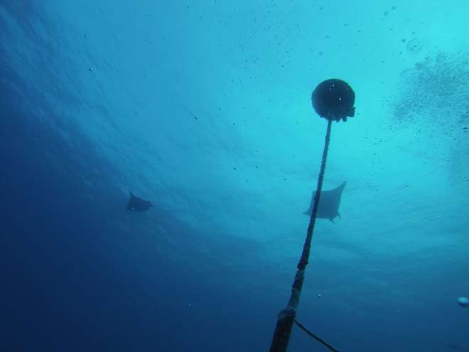
Manta rays swimming over acoustic receivers in the British Indian Ocean Territory
This year I am part of an international team of scientists, funded by the Bertarelli Foundation, onboard the Tethy’s Supporter, a vessel that came across from the Seychelles to support this expedition. We rendezvoused and boarded the vessel in the Maldives six days ago but unfortunately the weather has not been on our side thus far. Our two-day transit down from the Maldives was dogged by choppy seas resulting in our boat bobbing around the ocean like a child’s bath toy. Those transit days were spent checking dive gear and prepping shark tagging equipment, whilst the nights were spent trying to get some sleep although the ocean and the boat were working in perfect tandem to try and roll us out of our bunk beds. I was regretting my foolish and naive nabbing of a top bunk. It’s a long way down to the cabin floor…. After two pretty much sleepless nights, we were all relieved to arrive to the relative calm of Salomon Atoll. Once inside, we were sheltered from the big swell that had been raging from the west and were able to get some much-needed rest.
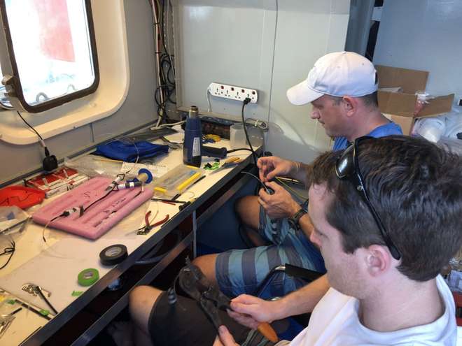
Scientists prepare electronic fish-tags whilst en route to the British Indian Ocean Territory
The following morning, we divided into two teams to set about our primary objective, to service the extensive acoustic receiver array network we have installed around the atolls out here. Each receiver logs the occurrence of any tagged shark that may swim within its detection range (~500m) and we have installed 76 such receivers across the archipelago over the last few years. On this expedition we will be SCUBA diving on each one (~20-25m), replacing the old receiver with a fresh new one, and bringing the old receiver to the surface to download the data. That’s the exciting bit – finding out what it has recorded over the last few years.
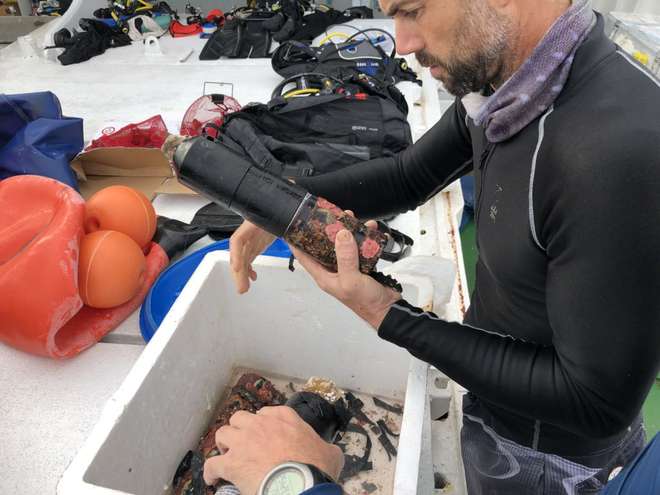
David Tickler of the University of Western Australia cleans and services one of the acoustic receivers which has been collecting data in the British Indian Ocean Territory
Our first morning however didn’t quite go to plan, with the persistent swell meaning we weren’t able to access some of our sites around Salomon safely in our dive boats. It was no trouble for the resident spinner and bottlenose dolphins however, who we could see effortlessly playing in the rough water around the atoll almost mocking us with the ease with which they managed the swell. Still, they were very cool to see.
As the acoustic array can only detect animals that have been equipped with specific acoustic tags, we of course have to attach these devices to animals. However, the weather conditions have just made it too tricky to tag any sharks or manta rays just yet. So, for now we are focusing on servicing as many receivers as we can and will focus on tagging more once the weather improves. After servicing all of the receivers that we could around Salomon, the following morning we headed west to Peros Banhos atoll. This massive atoll (~25km across) is where the vast majority of our receivers are located. A few days servicing receivers there we headed east to Nelson Island where we are now anchored.
The good news is that the weather is clearing so a shark tagging boat should be going out this afternoon. Will update you on what we catch in the next blog…
For more science updates from the British Indian Ocean Territory, follow @BIOTscience on Twitter.
The Bertarelli Foundation has, for some time, supported a number of projects in the Indian Ocean which use tagging technology to further our knowledge of animals such as sharks, tuna, manta rays and sea turtles. By following their migrations, sometimes over great distances, scientists can begin to understand more about their behaviour and their ecology.
A scientific paper by Prof. Graeme Hays of Deakin University and Nicole Esteban of Swansea University recently published in Frontiers in Marine Science, suggests that tagging data might actually be used by scientists for another purpose – to map seagrass habitats. Not only are seagrass meadows a valuable habitat for many marine species but they also provide ecosystem services worth trillions of dollars (USD) each year. Seagrass meadows have a role in mitigating climate change, they protect coastal areas from erosion, and they improve the health of neighbouring coral colonies. Mapping seagrass meadows – and any changes in seagrass distribution – is therefore of vital importance to us all.
As part of the Bertarelli Programme in Marine Science the researchers have attached satellite tags to a number of species of sea turtle, including green turtles, in the British Indian Ocean Territory. This has provided valuable insights about how they range across thousands of kilometers, and even suggested how they might locate tiny islands in the vastness of the Indian Ocean.
Now the scientists have also shown that it is possible to use this tracking data to identify where seagrass meadows might be located and which areas warrant further investigation and survey.
In late April and early May, Dr David Jacoby of the Zoological Society of London and Dr Taylor Chapple of Stanford University spent a week at sea attempting to retrieve data from deep-sea receivers scattered across the marine reserve in the British Indian Ocean Territory. The receivers pick up signals from pelagic animals that the team tagged on previous trips including sharks, rays and tuna – the big predators that are hard to study but absolutely key to a healthy ecosystem. These 16 receivers were deployed in 2016 in a variety of deep-water habitats such as sea mounts and undersea canyons, places too deep for divers and until now virtually unstudied by scientists.
In just six days, with the help of the crew of the British Patrol Vessel Grampian Frontier, the team traversed the Chagos Archipelago from end to end travelling over 500 miles. They managed to retrieve 12 of the 16 receivers by using an automated acoustic release system which ‘calls’ the receiver from the surface causing it to break free of its mooring and float up to be collected by the team.
Early analysis of the data from the receivers has revealed an incredible wealth of information; over 500,000 individual detections were downloaded – each one an individual pass of a tagged animal past one of the receivers. Receivers located at the Schwartz and Sandes seamounts in the south of the archipelago made detections of 159 unique individuals and are starting to reveal some of the connectivity between these deep habitats.
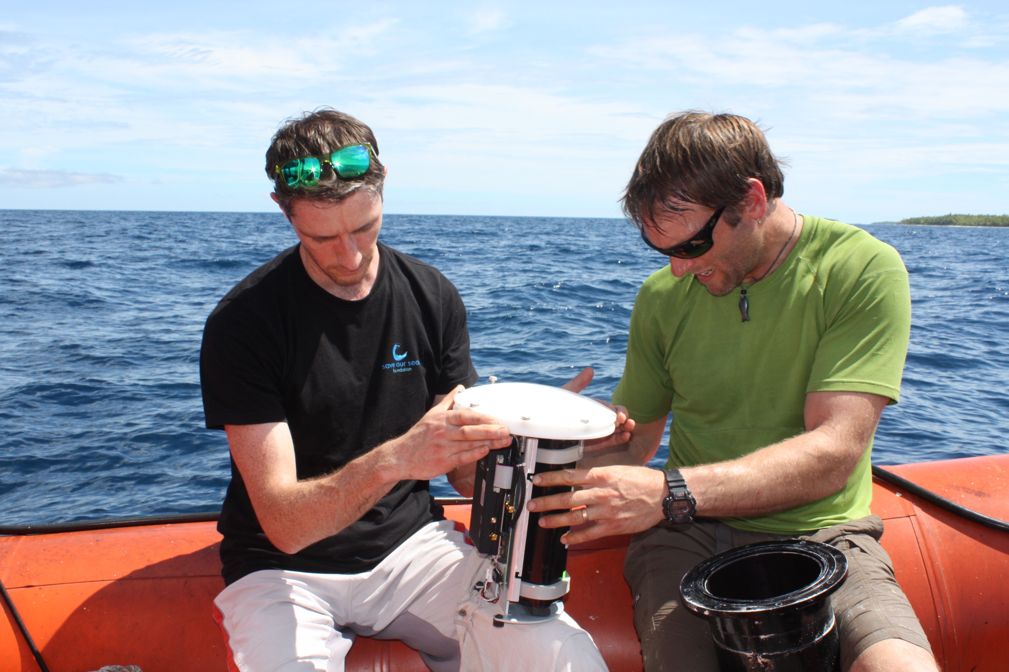
Dr David Jacoby and Dr Taylor Chapple service and replace the battery in a VR4 acoustic receiver, just south of Peros Banhos in the Chagos Archipelago, so that it will continue transmitting live data for another year.
Additionally, an Acoustic Doppler Current Profiler, retrieved from ‘Manta Alley’ at Egmont Island has collected information about the current profiles of this newly discovered manta highway and will provide vital environmental data for assessing why this area if so important for this iconic species.
Though short, this trip was very successful and will reveal more of the habitats and movements of these amazing species around this huge marine protected area. The acoustic receiver array, funded by the Bertarelli Foundation, is contributing to a long-term data set that is unparalleled in its size and geographic coverage and continues to grow by the day. All the data are now on their way back to the lab at Stanford University for in-depth analysis.