


The Bertarelli Foundation has, for some time, supported a number of projects in the Indian Ocean which use tagging technology to further our knowledge of animals such as sharks, tuna, manta rays and sea turtles. By following their migrations, sometimes over great distances, scientists can begin to understand more about their behaviour and their ecology.
A scientific paper by Prof. Graeme Hays of Deakin University and Nicole Esteban of Swansea University recently published in Frontiers in Marine Science, suggests that tagging data might actually be used by scientists for another purpose – to map seagrass habitats. Not only are seagrass meadows a valuable habitat for many marine species but they also provide ecosystem services worth trillions of dollars (USD) each year. Seagrass meadows have a role in mitigating climate change, they protect coastal areas from erosion, and they improve the health of neighbouring coral colonies. Mapping seagrass meadows – and any changes in seagrass distribution – is therefore of vital importance to us all.
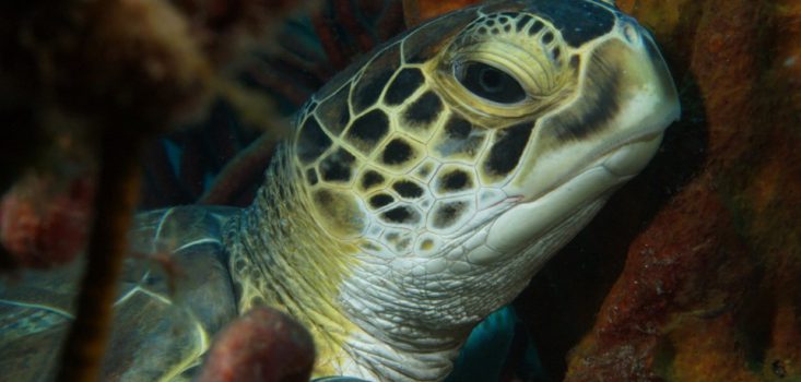
As part of the Bertarelli Programme in Marine Science the researchers have attached satellite tags to a number of species of sea turtle, including green turtles, in the British Indian Ocean Territory. This has provided valuable insights about how they range across thousands of kilometers, and even suggested how they might locate tiny islands in the vastness of the Indian Ocean.
Now the scientists have also shown that it is possible to use this tracking data to identify where seagrass meadows might be located and which areas warrant further investigation and survey.